U of M Biological Station: Gorge Trails

Buy the $.99 downloadable map!
(This map is not geo-referenced)Trail Details

Founded in 1909 on land acquired from lumber barons after the area had been logged, the 10,000-acre Biological Station is spread between Douglas and Burt Lake with shoreline on both. The trees have since grown back and the station now features a rich diversity of natural habitats: extensive forests of pine and northern hardwoods, conifer swamps, meadows, all types of wetlands, rivers and streams.
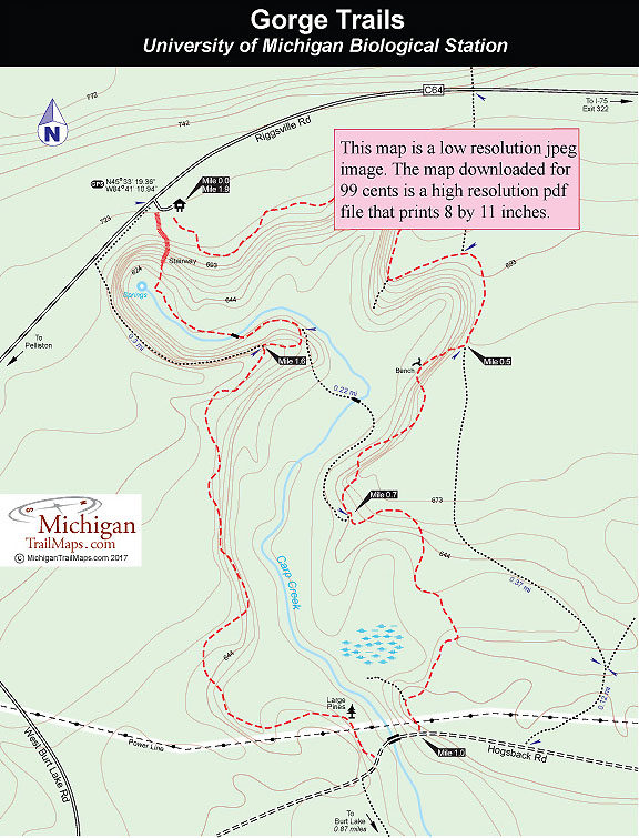
Much of the station is open to the public and spread across it is a trail system that is a favorite among locals as a Nordic destination in the winter. But the most interesting paths here are the Gorge Trails that skirt and dip into a ravine more than a 100 feet deep. The less leaves on the trees the better as you are able to stand on the edge of this cleft and peer at Carp Creek at the bottom or the walls on the other side that enclose this narrow gorge.
The gorge is an example of an erosional process call sapping, the result of Douglas Lake being 118 feet higher than Burt Lake. Water drains from Douglas Lake by seeping underground for a half mile and then reappearing as springs in head of the gorge. The springs are the headwaters of Carp Creek that flows almost 2 miles south before emptying into Burt Lake. Give this small stream credit; in 8,000 years it’s manage to carve an impressive ravine here.
Since 2005 locals and U of M students and staff has improved, marked and expanded the trail system around Carp Creek Gorge. In particular, a huge stairway at the head of the gorge was rebuilt allowing quick access to the springs at the bottom.
This 1.9-mile loop follows the edge of the ravine for the best views and then descends into it before using the stairway for an easier climb back to the trailhead parking area. To extend hike, you can add the point-to-point segment that heads south from Hogsback Road through Reese’s Swamp to Burt Lake, turning this into a 3.64-mile outing.
| Difficulty - Easy |
| Foot Path |


