Wolf Mountain Trail-Ottawa National Forest
Buy the $.99 downloadable map!
(This map is not geo-referenced)Trail Details

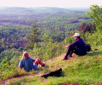
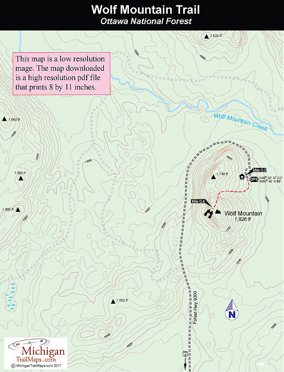
Wolf Mountain in Ottawa National Forest is such a place and it’s an ideal high camp for those with short legs. The 1,826-foot summit is the highest point in Gogebic County and a gorgeous place to enjoy long views to the south and west in a relatively undeveloped area. Lake Superior is not visible but the spot is still a favorite of locals who drive up for the fall colors in early October.
You drive within half a mile of the top, then a short hike takes you the rest of the way. At the peak there is more than enough space to pitch a tent or several of them.
| Camping |
| Difficulty - Easy |
| Foot Path |
Geo-referenced maps from MichiganTrailMaps.com range from $1.99 to $2.99 each.
Download the Avenza app from the App Store or Google Play


