Yuba Creek Natural Area

Buy the $.99 downloadable map!
(This map is not geo-referenced)Trail Details

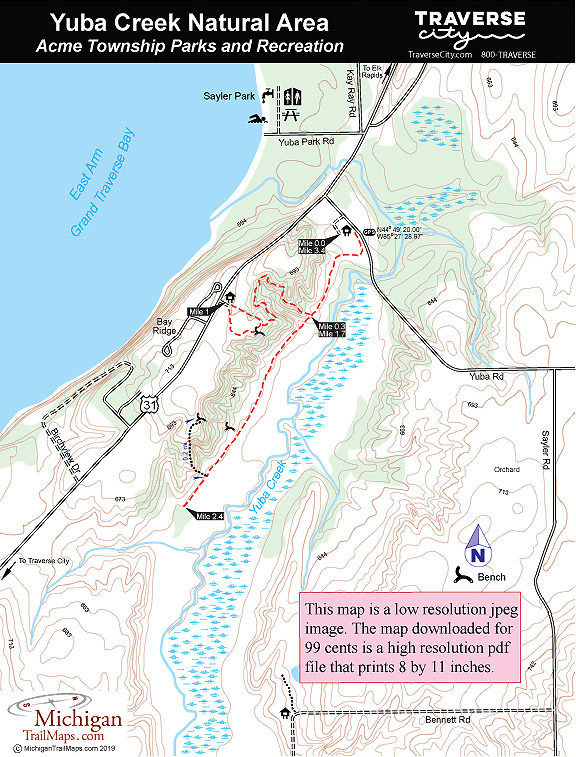
Purchased by Acme Township in 2002 with help from the Grand Traverse Regional Land Conservancy, Yuba Creek is a 413-acre preserve that features more than 5000 feet of its namesake stream, a mix of open and shrub-dominated wetlands, upland hardwood forest and abandoned orchards. Although Yuba Creek, a designated trout stream, no longer supports the fish due to a loss of aquatic habitat and shade, the area is bountiful in wildlife. That includes whitetail deer, otter and mink as well as ruffed grouse, raptors such as red-tailed hawk, roughlegged hawk, and coopers hawk and large numbers of waterfowl and geese. A pair of eagles also nest in the area.
The park is undeveloped with the exception of three access points. The most visible one is a scenic overlook on US-31, across from the entrance to Bay Ridge development, and features a parking area and an interpretive display. There is also a 0.3-mile trail that loops to the edge of the ridge, the highest ground of the entire property. Here you’ll find a bench where you can see most of the creek below you and possibly even the eagle’s nest across the valley. There is also an access point with roadside parking on Bennett Road, near the curve of the road, at the south end of the natural area.
But the main access point is on Yuba Road, just east of US-31, that has a parking area and a trailhead for the main trail. Described and mapped below, the trail is open to hikers as well as snowshoers and Nordic skiers in the winter. But mountain bikes and off-road motorized vehicles are banned. The point-to-point route runs almost the length of the valley while a spur branches off to climb the western ridge. A round-trip hike, that includes climbing to the scenic overlook on US-31, is only 3.4 miles but it’s enough to allow you to escape the noise and traffic of the state highway for the quiet bliss of this well-hidden valley.
| Difficulty - Easy |
| Foot Path |


