320

Trails Reviewed

Find Trails & Maps

Search for Trail
Search by Location
Search by

Back to listing

Avalanche Preserve Recreation Area

Trail Details

County
Charlevoix
Regions
Northwest
Latitude
N 45° 12' 3.24"
Longitude
W 085° 00' 52.20"
Distance
2 to 4.2 miles
Trail Type
Multi-use Trails
Terrain
Forested ridge
Difficulty
Moderate to challenging
Nearest City or Town
Boyne City
(map loads here)
view map
Located on the southwest corner of the Boyne City, Avalanche Peak rises to 1023 feet or 439 feet above Lake Charlevoix to provide the most commanding view of any high point south of the Mackinac Bridge. This towering ridge is the center piece of Avalanche Preserve Recreation Area, a 300-acre Boyne City park that is predominantly a forested sloping terrain and features mountain bike, hiking and and cross country ski trails.
Expand All
Photos
Description
There is no record of an avalanche ever barreling down Avalanche Peak into Boyne City, but the hill is incredibly steep—so steep that in the 1950s, it was a downhill ski area with rope tows and even a chairlift. Located on the southwest corner of the city, Avalanche Peak rises to 1023 feet or 439 feet above Lake Charlevoix to provide the most commanding view of any high point south of the Mackinac Bridge.

This towering ridge is the center piece of Avalanche Preserve Recreation Area, a 300-acre Boyne City park that is predominantly a forested sloping terrain. The exception is its northern slope that was the site of a downhill ski operation beginning in the early 1950s. By 1958 the downhill had a 1500-foot poma lift and later a double chairlift before closing in the 1960s.

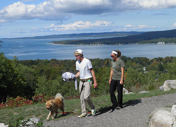
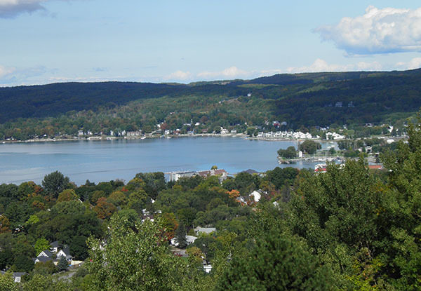
In the fall the hill is a favorite for leaf peepers who scale a 462-step stairway to a pair of observation decks near the top from which they can gaze down at Boyne City, practically all of Lake Charlevoix and even a sliver of Lake Michigan on a clear day. In the winter the park is renowned as one of the most thrilling sledding hills in northern Michigan.

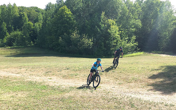
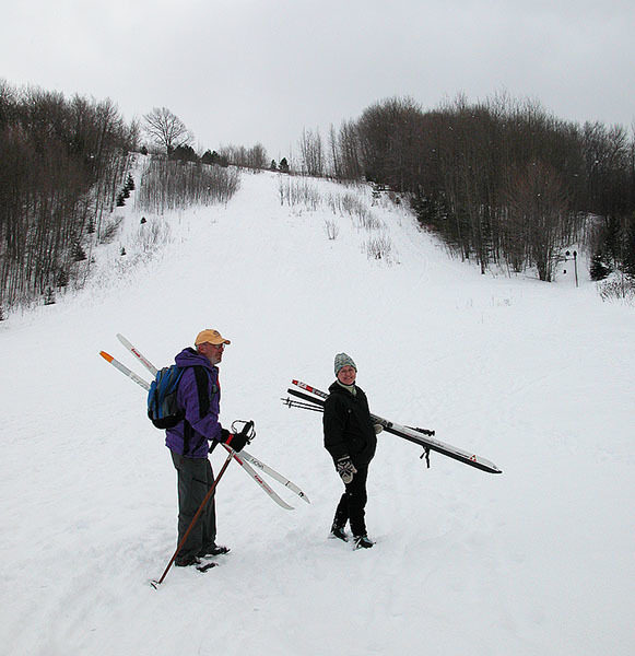
Winding up and around the ridge is a 12-mile trail system that includes an 8.6-mile mountain bike system and a 2.8-mile hiking trail that is open to cross-country skiers and snowshoers. The park also features an 18-hole disc golf course with much of it laid out along the walking trails.

Needless to say, mountain biking and Nordic skiing at the park are rated challenging due to the extensive change in elevation experienced along both loops. Just climbing the stairway to the view at the top can be a workout for many people.
Amenities & Services
Difficulty - Challenging
Difficulty - Moderate
Dog Friendly
Multi-use Trail
Two-Track
Trail Guide

Click on highlighted trails below for more detailed maps and descriptions of the trails.

Mountain Bike Trail 8.6 miles Mountain bike
Hiking Trail  2.8 miles Hike
Ski Trails 2.8 miles Nordic ski

Facilities

At the base of the hill is the Avalanche Warming Shelter that includes restrooms, drinking water and loaner skates for the ice skating ring. At the observation area at the top is a pair of viewing decks with benches, a vault toilet and drinking fountain.

Hours & Fees

There are no entry or vehicle fees for Avalanche Preserve Recreation Area. The warming shelter is open during the winter hours from 4-9 p.m. Monday through Friday and 11 a.m. to 9 p.m. Saturday and Sunday.

Directions

From US-131, north of M-32, follow M-75 into Boyne City. Once in town head west on Division Street and then turn left on Lake Street. Signs at the south end of Lake Street direct you left to the entrance of Avalanche Preserve Recreation Area at 1129 Wilson Street.

Information

For more information Contact the Boyne City Parks Department (231-582-6597) or check the Boyne City web site.


Geo-referenced maps from MichiganTrailMaps.com range from $1.99 to $2.99 each.

Download the Avenza app from the App Store or Google Play

App Store Google Play

Michigan TrailMaps.com Michigan's Premier Trail Resource Contact

Trail Mix News

by travel and outdoor writer Jim DuFresne!

Sign Up
Enews Signup
Find a Trail

Find Trails & Maps

Search for Trail
Search by Location
Search by