For-Mar Nature Preserve: Edge of the Woods Trail
Buy the $.99 downloadable map!
(This map is not geo-referenced)Trail Details
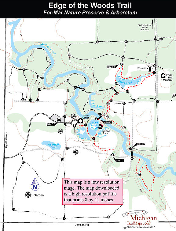
This 2-mile route, a combination of a dozen short segments, leads you through the most interesting sections of the preserve; the wooded floodplain of Kearsley Creek and the collection of ponds and wetlands in the heart of the park. Along the way you pass a wetland observation tower, a historic windmill and, if it’s Sunday, can stop and view the Corydon E. Foote Bird Museum.
For much of this hike you are either in the woods or skirting the edge of them with fields on one side and trees on the other. And in such a setting you have as good a chance to spot wildlife here as anywhere in the preserve.
The hike begins in the main parking area at For-Mar, reached from Genesee Road but within a 100 yards you reach Forbes and Martha Merkley Visitor Center, where you can fill the water bottles, grab a trail map or give the kids a quick natural history lesson before hitting the trail. The Merkley Visitors Center is open Wednesday through Sunday from 8 a.m. to 5 p.m. The Foote Bird Museum is open every Sunday from 2-4 p.m.
In the spring it’s a good idea to call the visitor center (810-789-8567) is advance to make sure the trails are not flooded and all the bridges are intact. In May and June, pack along bug repellent.
Geo-referenced maps from MichiganTrailMaps.com range from $1.99 to $2.99 each.
Download the Avenza app from the App Store or Google Play


