Fred Russ Forest Park

Buy the $.99 downloadable map!
(This map is not geo-referenced)Trail Details
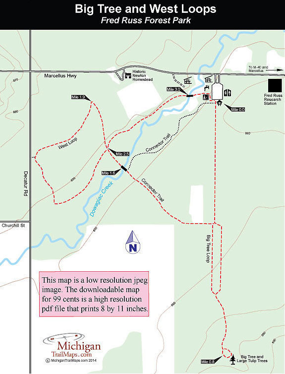

Located on a rural road between Dowagiac and Marcellus, Fred Russ is a 13-acre Cass County park surrounded by Michigan State University’s 580-acre Russ Forest Research Station. The entire area is laced by more than 4 miles of trails, open to hiking and cross-country skiing in the winter, while gently flowing through the middle of it is Dowagiac Creek, a Class A trout stream highly regarded among anglers for brown trout.
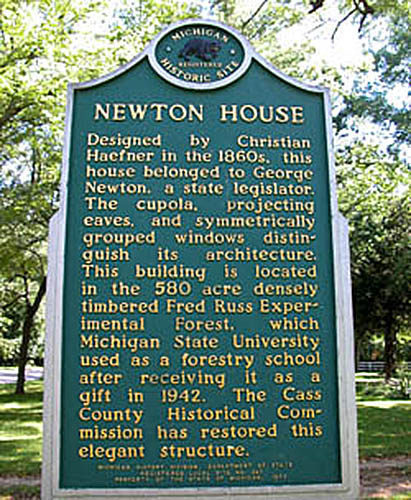
Even if you’re not into fishing, the rich history - on the edge of the forest is the historical Newton House built in the 1860s - and natural beauty make Fred Russ one of the most popular parks in Cass County. Among other things, Russ Forest is home of the largest tulip poplar tree in Michigan.
By combining Big Tree Loop and West Loop, you can enjoy a moderately easy walk of 3.2 miles that includes seeing the remnants of a giant tulip tree and, depending on the season, possibly even a trout or two rising to an insect hatch. You can shorten the hike to just 1.6 miles by hiking only Big Tree Loop or West Loop.
At one time the park was part of a farm, and a huge red barn still stands near the parking lot. Nearby is a display containing a third of what was once the largest tulip tree in Michigan. Known simply as the “Big Tree,” it was 200 feet tall with a girth of 23.6 feet when a violent storm blew it down in 1984. Big Tree Loop leads due south out to the rest of the trunk and its massive stump.
| Difficulty - Easy |
| Dog Friendly |
| Foot Path |
Geo-referenced maps from MichiganTrailMaps.com range from $1.99 to $2.99 each.
Download the Avenza app from the App Store or Google Play


