320

Trails Reviewed

Find Trails & Maps

Search for Trail
Search by Location
Search by

Back to listing

Isle Royale NP: Rock Harbor Trail - Map 2

Trail Details

County
Houghton
Regions
Western Upper Peninsula
Latitude
N 48° 04' 45.84"
Longitude
W 088° 37' 8.04"
Distance
11.1 miles
Trail Type
Backpacking
Terrain
Rock Harbor Inlet
Difficulty
Easy to moderate
Nearest City or Town
Houghton
(map loads here)
view map
Beyond Starvation Point the Rock Harbor Trail continues to follow the rugged shoreline of Rock Harbor Inlet. But the western half of the trail, a 3.9-mile segment from Daisy Farm to Moskey Basin, swings inland and is more difficult than the first half.
Expand All
Photos
Description
Beyond Starvation Point the Rock Harbor Trail continues to follow the rugged shoreline of Rock Harbor Inlet, providing stunning views with almost every step. But the western half of the trail, a 3.9-mile segment from Daisy Farm to Moskey Basin, swings inland and is more difficult than the first half but not nearly as laborious as it used to be. This section has been rerouted over time to make it an easier walk over the rocky terrain.

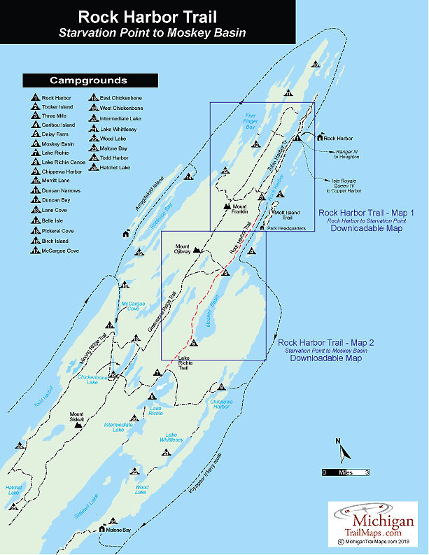
Moskey Basin is a beautiful campground situated right off the well-protected waters at the end of Rock Harbor. It offers six shelters, group and individual campsites, pit toilets, a large dock, and some spectacular sunrises that are well worth leaving a warm sleeping bag in the morning. Climb the rocky bluffs above the dock for an incredible view down the length of Rock Harbor.

Heading west from Moskey Basin is the Lake Richie Trail, best known as the longest portage on Isle Royale at 2.1 miles. But backpackers use the trail to reach the Indian Portage Trail, which takes them to the Greenstone Ridge. Once on the Greenstone they can head east to return to Rock Harbor in 1-2 days or continue west and reach Windigo in 2-3 days. Indian Portage Trail also heads south from Lake Richie Trail and in 4.1 miles reaches to Chippewa Harbor Campground, another beautiful spot to spend the night.
Amenities & Services
Camping
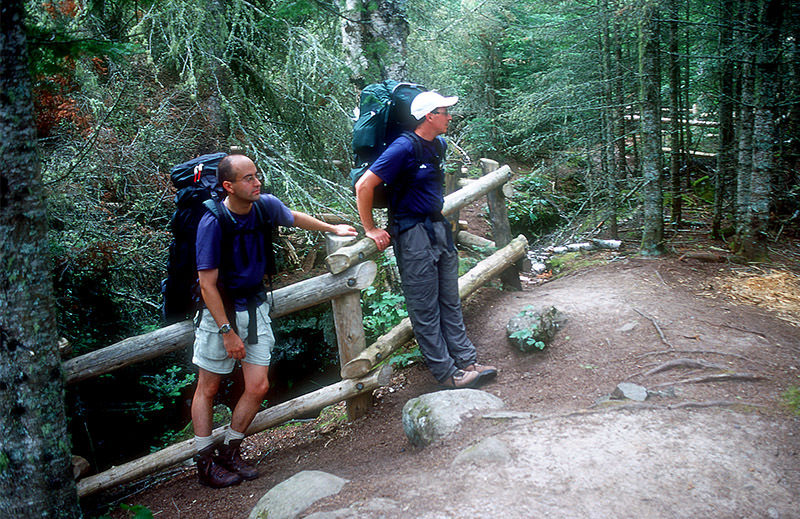
Difficulty - Moderate
Foot Path
Trail Guide

Rock Harbor Trail is covered with maps in Isle Royale National Park: Foot Trails & Water Routes by Jim DuFresne. To order the 192-page guide to the wilderness island, Click Here.

Facilities

The western half of Rock Harbor Trail connects two campgrounds. It begins at Rock Harbor Campground and reaches Daisy Farm (7.2 miles) before ending at Moskey Basin (11 miles). Needless to say all four campgrounds are among the busiest during the peak summer season of July and early August.

Shower tokens, clean towel, and bar of soap can be purchased at the camp store at Rock Harbor or Windigo. Some backpackers like to book a room for their final night at Rock Harbor, either at the lodge or in one of the housekeeping units that can be shared by six people and feature small kitchenettes. For reservations, contact the park concessionaire, Forever Resorts (866-644-2003 or 906-337-4993 in summer; www.isleroyaleresort.com).

Hours & Fees

Isle Royale National Park opens April 16 and closes on Nov. 1 to all visitors for the winter.  The park has a entrance fee of $7 per person per day or an annual pass for $60. You can pay the entrance fee once you arrive at the park or in advance at at pay.gov  and avoid congestion and long waits on the island. All park visitors who plan to camp overnight at campgrounds or cross-country sites are required to obtain a camping permit. This permit can be obtained free of charge at the visitor center at Windigo or Rock Harbor when you arrive or on board Ranger III on the way to the Island.

Directions

The Rock Harbor Lodge runs a water taxi that can drop backpackers and campers at Three Mile Campground, Daisy Farm Campground and Moskey Basin Campground.

Contact the Rock Harbor Resort (866-644-2003 or 906-337-4993 in summer; www.isleroyaleresort.com) to find out current schedule and costs of its watwer taxi service.

Information

Call the Isle Royale National Park headquarters in Houghton (906-482-0984) or check the Isle Royale National Park website (www.nps.gov/isro).


Geo-referenced maps from MichiganTrailMaps.com range from $1.99 to $2.99 each.

Download the Avenza app from the App Store or Google Play

App Store Google Play

Michigan TrailMaps.com Michigan's Premier Trail Resource Contact

Trail Mix News

by travel and outdoor writer Jim DuFresne!

Sign Up
Enews Signup
Find a Trail

Find Trails & Maps

Search for Trail
Search by Location
Search by