Metamora-Hadley Recreation Area
Buy the $.99 downloadable map!
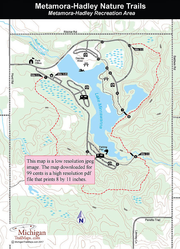
(This map is not geo-referenced)Trail Details

Metamora-Hadley is a lightly used park whose busiest period is a series of Halloween-Harvest Festival staged on most October weekends for campers. The same holds true for its trail system. Arrive in the middle of the week and you’ll probably encounter only a handful of other hikers. The trails attract few skiers in the winter as they are not groomed while mountain biking is prohibited.
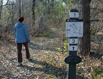
In the mid-1980s a Girl Scout troop set up a mile-long self-guided nature trail with 13 numbered posts scattered from the main trailhead to the south campground loop. You can still see many of the posts today but the accompanying brochure hasn’t been offered in years.
Collectively the trails are referred to as the Metamora-Hadley Nature Trails and do feature a series of interpretive plaques focusing on natural history and tree identification. The perimeter of the system plus a portion along the park road that returns you to your vehicle is only a hike of 3.85 miles and is described below. For even a shorter, 1.2-mile loop begin at post No. 11 in the park’s day-use area. Hike to the foot bridge at post No. 7 and once on the other side loop back to your vehicle via posts No. 6, 13 and 12.
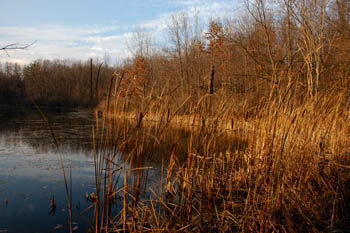
There are numerous unofficial paths in the area but most of them have been blocked off with small wooden barriers and overall the trail is well posted and easy to follow. Some stretches along Lake Minnawanna are scenic but in general this is a stroll through woods and fields. Even without grand scenery Metamora-Hadley can still be a pleasant escape that will sooth the soul at the end of a hectic week.
| Camping |
| Difficulty - Easy |
| Dog Friendly |
| Foot Path |
Geo-referenced maps from MichiganTrailMaps.com range from $1.99 to $2.99 each.
Download the Avenza app from the App Store or Google Play


