North Point Nature Preserve

Buy the $.99 downloadable map!
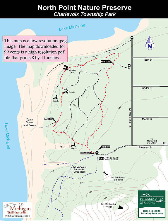
(This map is not geo-referenced)Trail Details
The small preserves was purchased in 1988 in an effort spearheaded by the Little Traverse Conservancy that included applying for a grant from the Michigan Natural Resources Trust Fund and organizing a local fundraising campaign. The land was eventually deeded by the Little Traverse Conservancy to Charlevoix Township as a public nature preserve.
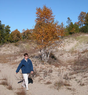
North Point not only contains a stretch of undeveloped lakeshore in the middle of this tourist town but three threatened plant species as well: Pitcher’s Thistle, Lake Huron Tansy, and Pumpell’s Bromegrass. Despite being on the edge of a city, the preserve also harbors deer, porcupines, various shore birds and occasionally loons, eagles, and great blue herons.
The preserve lies adjacent to the Mt McSauba Receation Area, a 50-acre park that is dominated by its namesake dune and is the focal point of a city-operated downhill ski area. The recreation area also has a limited network of trails that merge into those with the preserve.
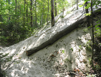
The 1.5 miles of trails at North Point are poorly marked and at times seem to be haphazardly laid out but it would be nearly impossible to get lost here. Walk 10 minutes in any direction and you arrive at either a road or Lake Michigan. The route describe below is a 0.65-mile loop that is composed of the best defined trails and is easy to follow.
The primary activity at the preserve is hiking. In the winter, cross-country skiers and snowshoers use the trails when there is sufficient snow.
| Difficulty - Easy |
| Foot Path |
Geo-referenced maps from MichiganTrailMaps.com range from $1.99 to $2.99 each.
Download the Avenza app from the App Store or Google Play


