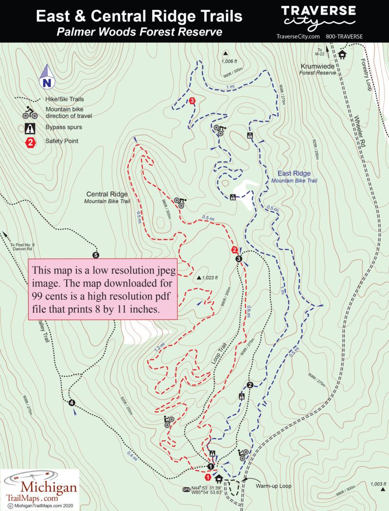
East Ridge Mountain Bike Trail
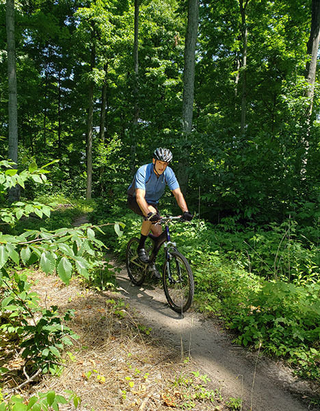
East Ridge offers a more challenging ride than the Central Ridge Loop with tighter corners, steeper slopes, and four black diamond sections. At the Wheeler Road Trailhead, East Ridge is the furthest trail to the east and it must be followed in a counterclockwise direction. It begins with a steady climb and within a third of a mile tops off at a small clearing with a view of trails below you.
After crossing an old two-track the loop progressively becomes more technical, beginning with a stretch of rollers at Mile 0.5. The first obstacle to be posted with a black diamond – a tight downhill berm to the right – is reached at Mile 1. After a bit of climbing, another challenging berm is encountered at the start of a wild downhill run that bottoms out at a rescue sign No. 3. More climbing tops off at signposted Mile 2.
The final mile is basically a climb up and over East Ridge itself with three black diamond optional sections along the way. The first is reach on the edge of a clearing within a third of a mile and features a 3-foot drop for those up for the thrill and a bypass to the left for those who are not. You’re speeding down the ridge when at Mile 2.8 the trail becomes a short rock garden and then crosses the Hiker’s Loop at post No. 2. Keep an eye out for walkers! Just beyond the junction is a double roller with another 3-foot drop and an optional trail to left.
Within 200 yards of the end, East Ridge and Central Ridge Trails merge for the final and largest jump of the day, a massive stone drop well marked in advance with a caution sign. The bypass spur is to the right and both end up at the Wheeler Road information display.
Central Ridge Mountain Biking Trail
The Central Loop is less technical but more grunt at least in the first half. Built in 2019, Central Ridge offers a harder climb, longer downhills and technical progression: eight tabletop stones for riders to master before facing the massive stop drop at the end. The trail must be followed in a clockwise direction.
The start of the Central Ridge is almost due west of the trailhead display and near one end of the Hiker’s Loop. The loop immediately swings north, crosses a two track that is the south end of Price Valley Trail and begins climbing. The climb is steady for more than a mile and unforgiving for those who haven’t warmed up. The single track utilizes switchbacks that allow you to sidle the ridge and twice makes short but steep drops.
At Mile 1.2 you top off at 1,006 feet where the trail levels out for a spell and features a pair of tabletops. Finally, you begin the descent of Central Ridge, passing a view through the trees of more ridges to the west. The rest of the ride is a delightful and well-deserved downhill run that weaves through a series of berms. There are a handful of tabletop drops along the way but always a way to skirt around them if you had problems with the first few.
Just after passing rescue sign No. 2, you cross the Hiker’s Loop – post No. 3 – at Mile 2.2 and then enjoy a few more sweeping embankments before arriving where the East and Central loops merge together. Head left for the big stone jump or right to avoid it.