
Pine Baron Pathway
Buy the $.99 downloadable map!
(This map is not geo-referenced)Trail Details


Although it is technically a pathway in the Mackinaw State Forest, Pine Baron is more like a city trail on the edge of Gaylord. The pathway is less than 3 miles from the heart of the Ostego County seat and so endeared by locals that they fund its grooming during the winters when the Department of Natural Resources can not.
Named for the lumber barons who clear cut the land in the late 1800s, Pine Baron was built in 1978 as primarily a cross-country ski trail in a region of Michigan that averages more than 180 inches of snow per winter.
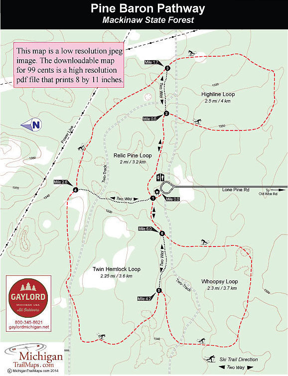
The pathway is a set of four, interconnected loops that range in length from 2 to 2.5 miles and fan out from a parking area into a forest of hardwoods and pines. The trail's perimeter is a 6.2-mile route while three crossover spurs and a pair of two-tracks that bisect the system makes its easy to put together an outing of almost any distance.
Three loops, the 2.5-mile Highline Loop, 2-mile Relic Pine Loop and the 2.25 mile Hemlock Loop, are relatively flat with only a few minor changes in elevation. The 2-mile Whoopsy Loop does include a few more descents and climbs but is still only mildly challenging even for novice skiers.
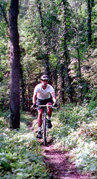
Pine Baron is most popular in the winter when it is groomed as a double-tracked trail for classic Nordic skiing. The rest of the year it attracts mainly mountain bikers, especially those new to off-road riding and looking for a gentle, undulating path in the woods. More serious mountain bikers usually head to the far more challenging single-track in Gaylord's Aspen Park.
Although Pine Baron is not the wilderness-like setting of many of the trails just to the north in the Pigeon River Country State Forest, it does make for a quick and pleasant outing for anybody staying or passing through Gaylord. In early October it's a beautiful place to soak in the autumn colors.
| Difficulty - Easy |
| Dog Friendly |
| Groomed Classic Skiing |
| Mountain Bike Single Track |
Geo-referenced maps from MichiganTrailMaps.com range from $1.99 to $2.99 each.
Download the Avenza app from the App Store or Google Play


