Pointe Mouillee SGA: Middle Causeway Loop
Buy the $.99 downloadable map!
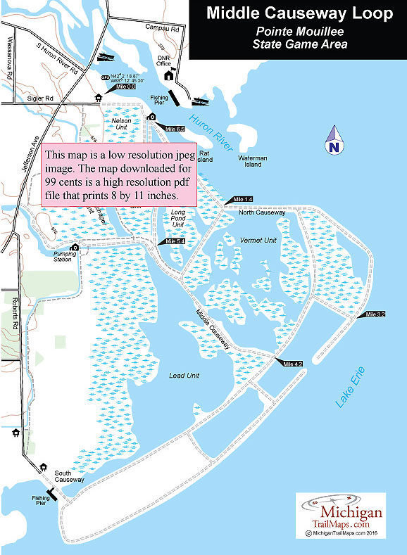
(This map is not geo-referenced)Trail Details


Middle Causeway is a dike that cuts across the heart of Pointe Mouillee and not only allows you to hike a shorter loop than following the perimeter dikes but leads you through the most interesting sections of the state game area. This is particularly true in April-May and September-October when the spring and fall migrations are taking place and the birdlife will be vibrant in the adjacent marshes and ponds. But arrive anytime during the summer and the waterfowl spotted will still be the highlight of this trek. A pair of compact binoculars add considerable to this outing even if you’re not a birder as well as a bird book if you’re interested what’s flying overhead.
A walk of 7 miles may seem like a lot to some people but keep in mind that there is no elevation gain whatsoever and that the dikes are well marked and easy to follow. That and the fact the wetland scenery is so unusual makes this hike seem a lot shorter than it is. The loop can be walked in tennis shoes even though at times during the spring you can encounter mud along some dikes. On any clear day, a wide-brim hat and sunscreen are needed as little shade will be encountered anywhere along the loop.
| Difficulty - Easy |
| Multi-use Trail |
Geo-referenced maps from MichiganTrailMaps.com range from $1.99 to $2.99 each.
Download the Avenza app from the App Store or Google Play


