Proud Lake Recreation Area
Buy the $.99 downloadable map!
(This map is not geo-referenced)Trail Details


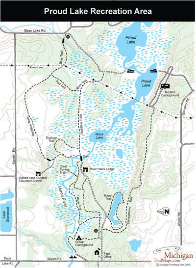
The heart of the park, and all its hiking trails, extends from Proud Lake west along the Huron River valley to Wixom Road. From Wixom Road, a dirt access road heads east to the park headquarters, main trailhead, group campsite and the Red Hawk Conference Center. West of Wixom Road is almost 9 miles of equestrian trails that is also open to mountain bikers.
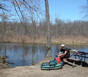
But mountain bikers are ban from the trails east of Wixom, an 11-mile system that winds along the Huron River and through the park’s extensive wetlands. This is by far the most interesting section of the park and the trails are well maintained with boardwalks and bridges that allow you to enjoy the area any time of the year without worrying about excessive mud. As to be expected, spring, particularly late April, is the best time to arrive and watch the marshes come alive with wildflowers, including hepatica, marigold and violets, while hiking to a chorus of spring peppers.
Trail names can be a bit confusing here as you will see River Trail and Chief Pontiac Trail being used as well as a system of colors – blue, red, green and orange – marking the various paths. Nothing seems to correlate to the maps handed out at the park office or from the DNR website. River Trail/Blue Trail is used here to describe the longest hike in the park, a 5.75-mile loop that will lead you from Wixom Road to Bass Lake Road and back again. It can be easily shortened in numerous ways.
For young children, the best hikes is either the 1.25 mile Marsh Trail or the Chief Pontiac Trail that makes for a 1.5-mile round-trip to the dam at Moss Lake. Both of these trails are easy, interesting and feature a series of interpretive plaques.
| Camping |
| Difficulty - Easy |
| Difficulty - Moderate |
| Dog Friendly |
| Foot Path |
| Multi-use Trail |
Geo-referenced maps from MichiganTrailMaps.com range from $1.99 to $2.99 each.
Download the Avenza app from the App Store or Google Play


