Sanilac Petroglyphs Historic Site
Buy the $.99 downloadable map!
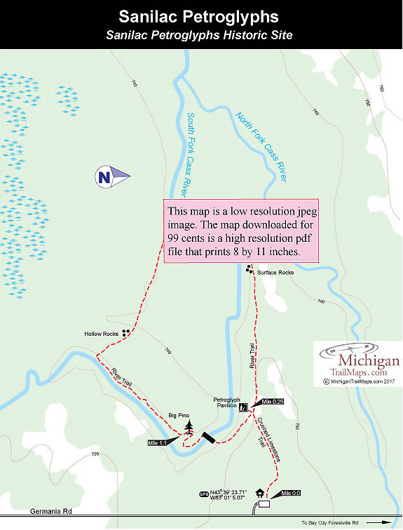
(This map is not geo-referenced)Trail Details

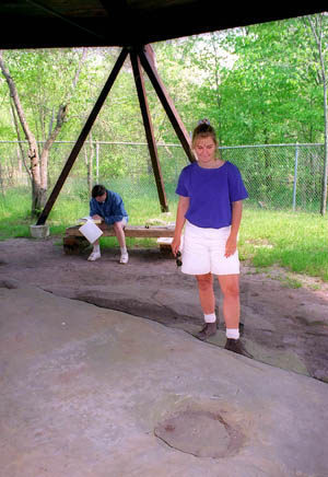
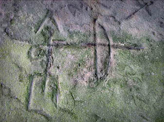
The main feature of the park is a large slab of sandstone with dozens of carvings on it that archaeologists believe to be 300 to 1,000 years old, dating back to the Late Woodland Period. Known as petroglyphs, these carvings are the only such ones ever found in Michigan and were discovered after massive forest fires swept the Lower Peninsula in 1881. Native Americans created this unusual artwork and today they provide a glimpse into the lives of an ancient woodland people who once occupied Michigan's Thumb area.
From the petroglyphs a 1.5-mile trail winds through the 240-acre state park unit. Scattered along the trail are five interpretive panels that explain the ecology and early history of the area. At one point there were 10 numbered posts along the trail that corresponded to an interpretive brochure. Today most of the posts, if not all, are gone as well the brochure.
This is an easy hike that takes most families an hour or two to enjoy the carvings and walk the trail. In the spring parts of the route can be wet to the point where the streams might be even lapping over the bridges.
| Difficulty - Easy |
| Dog Friendly |
| Foot Path |
Geo-referenced maps from MichiganTrailMaps.com range from $1.99 to $2.99 each.
Download the Avenza app from the App Store or Google Play


