Seven Lakes State Park
Buy the $.99 downloadable map!
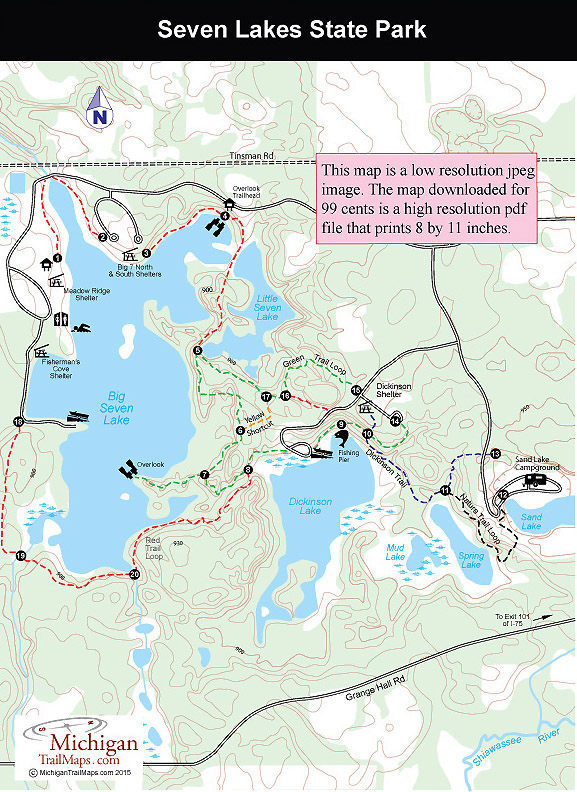
(This map is not geo-referenced)Trail Details

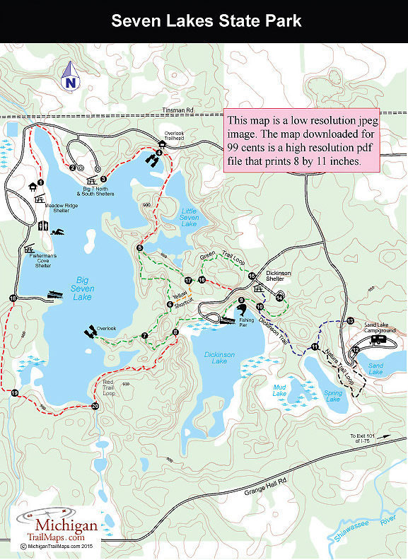
The 170-acre lake is an impoundment built by the developers who used a dam to turn a series of small lakes into a large body of water. After the project collapsed the land was sold to the state and in 1977 Seven Lakes State Park was opened. Unlike Pinckney, Brighton and many other state park units in southeast Michigan, Seven Lakes is not a patchwork of parcels, broken up by private holdings. The 1,434-acre unit is a single tract in northwest Oakland County with a 7-mile trail system that winds between and often along the various lakes. This can be a scenic place to hike or mountain bike, particularly the Green Trail Loop, a 2.25-mile loop that connects the park’s three largest lakes.
With exception of the Dickinson/Nature Trail Loop, all trails are open to mountain biking. Hardcore bikers, however, usually congregate at Holdridge Lakes Mountain Biking Area in nearby Holly Recreation Area where they enjoy far more mileage and challenging segments of single track.
| Camping |
| Difficulty - Easy |
| Difficulty - Moderate |
| Multi-use Trail |
Geo-referenced maps from MichiganTrailMaps.com range from $1.99 to $2.99 each.
Download the Avenza app from the App Store or Google Play


