Shiawassee Wildlife Refuge: Ferguson Bayou Trail

Buy the $.99 downloadable map!
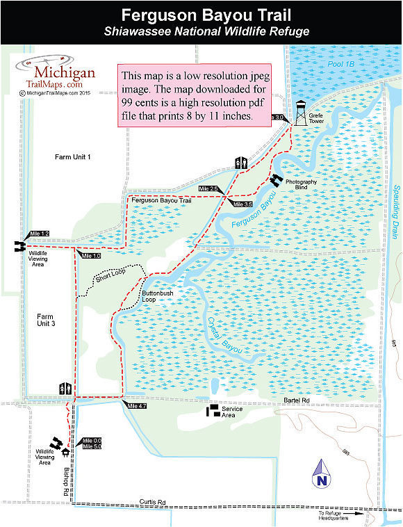
(This map is not geo-referenced)Trail Details

The Ferguson Bay Trail in the Shiawassee National Wildlife Refuge is an interesting walk almost any time of the year, as it provides dry footing through an area of marshes, ponds, sloughs, flooded forests and other moist soil units managed for a variety of wildlife. But during the peak migration seasons of March through April and September through early November, this day hike offers an impressive view of waterfowl, especially Canada geese. At the height of migration, some 25,000 geese and 40,000 ducks gather on the refuge.
From the observation tower, the halfway point of the 5-mile hike, you can watch flocks of hundreds rise in unison off the water, circle the refuge twice, and then depart. You are also sure to spot muskrats and possibly a variety of other wildlife, including great blue heron, great egrets, bald eagles, or some 200 other species of birds, as well as beaver or white-tailed deer.
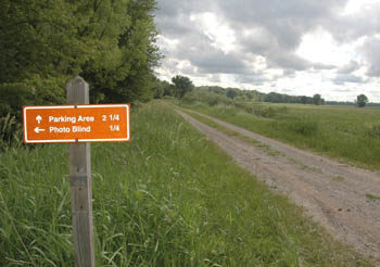
The entire trail system totals 5.5 miles with the main trail being a 4.75-mile figure-eight from the trailhead parking lot to the Grefe Tower and back. The route described below includes a quarter-mile spur to an observation blind for a 5.25-mile outing while a crossover spur called the Short Loop reduces the hike to a 2-mile loop but misses the most impressive sections of the trail.
Calling Ferguson Bay Trail a trail is a little misleading. What you are walking on most of the time is a series of dikes that form a maze through the heart of the refuge. On either side of you might be a marsh, a flooded pond, a wooded area, or a field of corn planted to provide food for waterfowl. Most likely you’ll see muskrats swimming in ponds or scurrying down the dikes, but keep a sharp eye out for ducks, other birds, turtles, or the downed trees that were gnawed by beavers.
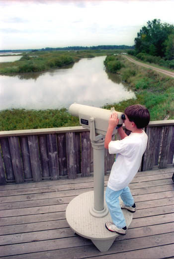
Ferguson Bay Trail is also open to mountain bikers and the hard, wide surface of the dikes makes it an ideal one for beginners or off-road cyclists whose main focus is to search for wildlife. Scattered along the trail are four observation decks, two with spotting scopes, and almost a dozen interpretive panels that focus on the refuge operations and wildlife.
| Difficulty - Moderate |
| Multi-use Trail |
Geo-referenced maps from MichiganTrailMaps.com range from $1.99 to $2.99 each.
Download the Avenza app from the App Store or Google Play


