Shiawassee Wildlife Refuge: Green Point Environmental Learning Center

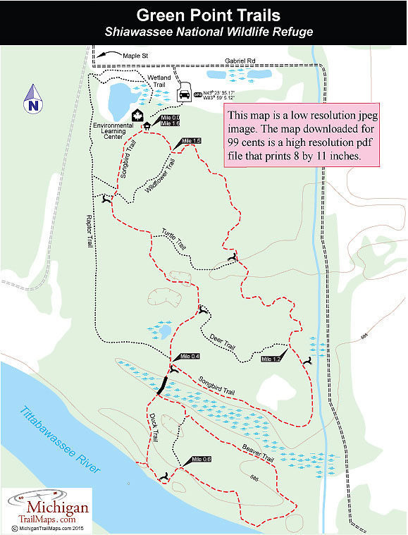
Buy the $.99 downloadable map!
(This map is not geo-referenced)Trail Details
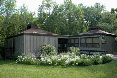

The Green Point Environmental Learning Center is a 76-acre natural area located within Saginaw, one of Michigan's largest cities, and across the Tittabawassee River from the Shiawassee National Wildlife Refuge, one of Michigan’s largest wetland ecosystems. Originally a city-operated nature center, Green Point closed in 1988 due to budget cuts but was re-opened five years later with the U.S. Fish and Wildlife Service managing the facility as an interpretive center for the refuge.
Along with the interpretive building with natural history exhibits, Green Point also offers a wide range of programs throughout the year and a network of short paths that wind 2.5 miles through the floodplain of the Tittabawassee River.
For a brief period every spring the river rises and often the entire trail system will be under water or so wet you would need hip boots to go hiking. In late May and June the bugs can be brutal here. But the rest of the year the center is a quick escape for locals, especially families, who want to sneak off into the woods without leaving the city. Mountain bikes are not allowed on the trail system but in the winter the trails are popular with cross-country skiers when there is sufficient snow.
Green Point features a variety of habitat and thus wildlife. You begin in a dense forest dominated by northern red oaks and hickory trees, pass woodland ponds, cross over a marsh, skirt the Tittabawassee River. Wildlife can range from a frogs and warblers to wild turkeys and whitetail deer.
For the most part the described route below follows the premiere of the trail system for an easy hike of 1.6 miles. Three crossover spurs; Wildflower Trail, Turtle Trail and Deer Trail, allow you to shorten the outing to whatever distance your group can handle while the Songbird Trail by itself is a mile-long loop.
| Difficulty - Easy |
| Foot Path |
Geo-referenced maps from MichiganTrailMaps.com range from $1.99 to $2.99 each.
Download the Avenza app from the App Store or Google Play


