Description
 Our Newest Waterproof Map
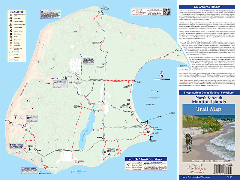
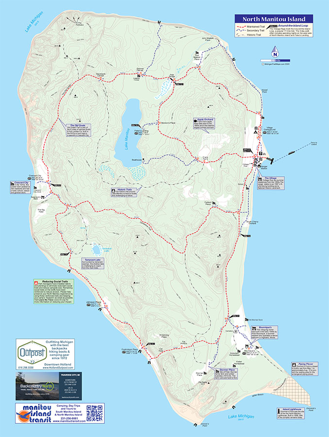
This map covers North and South Manitou, a pair of Lake Michigan islands that are part of Sleeping Bear Dunes National Lakeshore and reached by ferry service from Leland. North Manitou is 14,753-acre island that is 7.7 miles long, 4.2 miles wide and laced with 30 miles of designated trails and secondary trails. The 5,260-acre South Manitou features 17 miles of trails and primitive roads that provide day hikers and backpackers access to various historic sites, natural features and three walk-in campgrounds. Both islands are designated wilderness areas with a ban on motors, off-road vehicles, mountain bikes, and pets.
Produced by Michigan’s leading trail map publisher, this full-color, waterproof-tear resistant map measures 24 by 18 inches and covers North Manitou Island on one side and South Manitou Island on the other. North & South Manitou Islands Trail Map features contour lines in both meters and feet, designations and notes for historic ruins, scenic viewing points, campgrounds and shipwrecks. The map also features mileage for all the trails within the park and mileage flags for the most popular treks on each island; the Dunes Trail on South Manitou and the Around-the-Island Loop on North Mantiou.
MichiganTrailMaps.com combines GPS data, USGS elevation data and satellite imagery with good old fashion field research to produce the most accurate map of the Manitou Islands, a map that has been approved by the National Park Service. Best of all, North & South Manitou Islands Trail Map is produced by cartographers who have already hiked the trails you want to.