Description
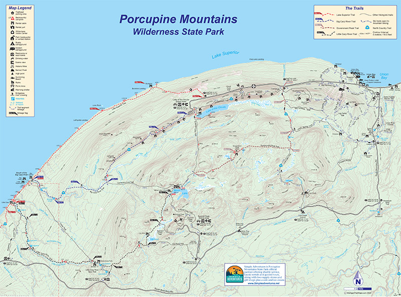
The best trail map of the Porcupine Mountains, produced by the same publisher responsible for the best guidebook to the park, is now even better.
The third edition of our Porcupine Mountains Wilderness State Park Trail Map is a 24-inch by 18-inch, two-sided map that is full color and includes all trails, cabins, yurts, and backcountry campsite locations along with interesting features such as waterfalls and historic mines. Improvements include numbers for all walk-in campsites. Seeing the location of them and the casmpsite’s number makes them a snap to reserve them online.
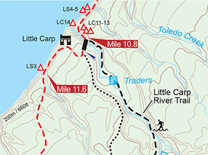 The map also features exact mileage for all the trails within the park and mileage flags for segments of the longest ones: Lake Superior Trail, Big Carp River Trail, Little Carp River Trail, and Government Peak Trail. Data for contour lines is provided in meters and feet, and short descriptions are provided for each path. Best of all, it’s printed on waterproof paper, just in case you drop it while fording the Big Carp River.
You can trust MichiganTrailmaps.com. Maps produced by cartographers who have already hiked the trails you want to.